Comparaison Wiki OpenStreetMap - Verifiability
fren
Comparaison détaillée des pages wiki en français et en anglais pour la clé OSM « Verifiability ».
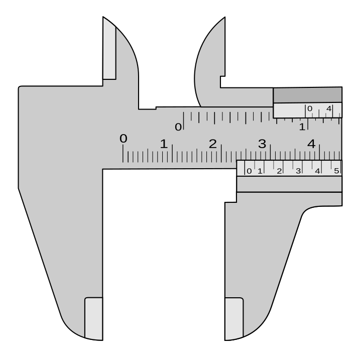
Illustration identique en anglais et en français
Évolution du score de décrépitude
Stable
sur les 7 derniers jours : le score de décrépitude n'a quasiment pas bougé (102.5 → 102.3), aucune modification notable de la traduction. Il reste au-dessus de la moyenne des pages suivies (56.7).
Détail des mesures (13 jours)
Date
Score de décrépitude
Diff. de mots
Diff. de sections
Diff. de liens
Diff. d'images
2026-10-05
102.3
595
8
36
0
2026-10-04
102.3
595
8
36
0
2026-10-03
102.3
595
8
36
0
2026-10-02
102.3
595
8
36
0
2026-10-01
102.3
595
8
36
0
2026-09-30
102.3
595
8
36
0
2026-09-29
102.3
595
8
36
0
2026-09-28
102.5
595
9
36
0
2026-09-27
102.5
595
9
36
0
2026-09-26
102.5
595
9
36
0
2026-09-25
102.5
595
9
36
0
2026-09-24
102.5
595
9
36
0
2026-09-23
102.5
595
9
36
0
Comparaison des sections
Commune aux deux languesManque en françaisManque en anglais
Le score de décrépitude est calculé en prenant en compte plusieurs facteurs, avec une pondération plus importante pour la différence de nombre de mots :
Facteur
Valeur
Poids
Contribution
Différence de date (en jours)
488
20%
97.6
Différence de nombre de mots
595
45%
2.98
Différence de nombre de sections
8
15%
1.2
Différence de nombre de liens
36
10%
0.54
Différence de nombre d'images
0
10%
0
Score total
102.32
Comment interpréter ce score :
Plus le score est élevé, plus la page française est considérée comme « décrépite » par rapport à sa version anglaise.
La différence de nombre de mots compte pour 50 % du score, car c'est l'indicateur le plus important de la complétude de la traduction.
Les différences de sections (15 %), de liens (15 %) et de date de modification (20 %) complètent le score.
Répartition des scores de décrépitude
Ce graphique montre la répartition des scores de décrépitude pour toutes les pages wiki et où se situe la page courante :
== Examples ==
== Flagging ==
== Community viewpoints ==
== What is verifiability? == (EN only)
=== Objective criteria === (EN only)
=== Improving verifiability by documenting values === (EN only)
=== Verifiable geometries === (EN only)
=== Statistical properties === (EN only)
=== Subjective opinions === (EN only)
=== Problematic tags === (EN only)
=== Planned features === (EN only)
== See also == (EN only)
height - https://wiki.openstreetmap.org/wiki/Key:height
height - https://wiki.openstreetmap.org/wiki/Key:height
height - https://wiki.openstreetmap.org/wiki/Key:height
highway - https://wiki.openstreetmap.org/wiki/Key:highway
highway - https://wiki.openstreetmap.org/wiki/Key:highway
smoothness - https://wiki.openstreetmap.org/wiki/Key:smoothness
primary - https://wiki.openstreetmap.org/wiki/Tag:highway%3Dprimary
trunk - https://wiki.openstreetmap.org/wiki/Tag:highway%3Dtrunk
Verifiability template - https://wiki.openstreetmap.org/wiki/Template:Verifiability
4Community viewpoints - #Community_viewpoints (EN only)
2Examples - #Examples (EN only)
3Flagging - #Flagging (EN only)
2.2Improving verifiability by documenting values - #Improving_verifiability_by_documenting_values (EN only)
2.1Objective criteria - #Objective_criteria (EN only)
2.7Planned features - #Planned_features (EN only)
2.6Problematic tags - #Problematic_tags (EN only)
5See also - #See_also (EN only)
2.4Statistical properties - #Statistical_properties (EN only)
2.5Subjective opinions - #Subjective_opinions (EN only)
2.3Verifiable geometries - #Verifiable_geometries (EN only)
1What is verifiability? - #What_is_verifiability? (EN only)
Harry Wood's blog - http://harrywood.co.uk/blog/2009/10/04/community-smoothness/ (EN only)
Tagging mailing list, Aug 2022 - https://lists.openstreetmap.org/pipermail/tagging/2022-August/065271.html (EN only)
https://wiki.openstreetmap.org/w/index.php?title=Verifiability&oldid=2782484 - https://wiki.openstreetmap.org/w/index.php?title=Verifiability&oldid=2782484 (EN only)
Average out GPS-traces - https://wiki.openstreetmap.org/wiki/Accuracy#GPS (EN only)
Document your custom tags - https://wiki.openstreetmap.org/wiki/Any_tags_you_like (EN only)
Don't copy from other maps - https://wiki.openstreetmap.org/wiki/Don%27t_copy_from_other_maps (EN only)
Don't mix the history - https://wiki.openstreetmap.org/wiki/Don%27t_mix_the_history (EN only)
Duck tagging - https://wiki.openstreetmap.org/wiki/Duck_tagging (EN only)
good practice - https://wiki.openstreetmap.org/wiki/Good_practice (EN only)
OSM good practices - https://wiki.openstreetmap.org/wiki/Good_practice (EN only)
Good practices - https://wiki.openstreetmap.org/wiki/Good_practice (EN only)
Do correct errors - https://wiki.openstreetmap.org/wiki/Good_practice#Do_correct_errors (EN only)
Do not trace from outdated imagery - https://wiki.openstreetmap.org/wiki/Good_practice#Do_not_trace_from_outdated_imagery (EN only)
Don't map historic events and historic features - https://wiki.openstreetmap.org/wiki/Good_practice#Don't_map_historic_events_and_historic_features (EN only)
Don't map local legislation if not bound to specific objects - https://wiki.openstreetmap.org/wiki/Good_practice#Don't_map_local_legislation_if_not_bound_to_specific_objects (EN only)
Don't remove tags that you don't understand - https://wiki.openstreetmap.org/wiki/Good_practice#Don't_remove_tags_that_you_don't_understand (EN only)
Keep straight ways straight - https://wiki.openstreetmap.org/wiki/Good_practice#Keep_straight_ways_straight (EN only)
Map curves with an appropriate number of nodes - https://wiki.openstreetmap.org/wiki/Good_practice#Map_curves_with_an_appropriate_number_of_nodes (EN only)
Map what's on the ground - https://wiki.openstreetmap.org/wiki/Good_practice#Map_what's_on_the_ground (EN only)
Mark estimations with fixme - https://wiki.openstreetmap.org/wiki/Good_practice#Mark_estimations_with_fixme (EN only)
Keep the history of an element - https://wiki.openstreetmap.org/wiki/Keep_the_history (EN only)
height - https://wiki.openstreetmap.org/wiki/Key:height (EN only)
place - https://wiki.openstreetmap.org/wiki/Key:place (EN only)
source - https://wiki.openstreetmap.org/wiki/Key:source (EN only)
source - https://wiki.openstreetmap.org/wiki/Key:source (EN only)
width - https://wiki.openstreetmap.org/wiki/Key:width (EN only)
Don't use name=* tag to describe things - https://wiki.openstreetmap.org/wiki/Names (EN only)
One feature, one OSM element - https://wiki.openstreetmap.org/wiki/One_feature,_one_OSM_element (EN only)
Relations are not categories - https://wiki.openstreetmap.org/wiki/Relations_are_not_categories (EN only)
Scope - https://wiki.openstreetmap.org/wiki/Scope (EN only)
hamlet - https://wiki.openstreetmap.org/wiki/Tag:place%3Dhamlet (EN only)
Don't map for the renderer - https://wiki.openstreetmap.org/wiki/Tagging_for_the_renderer (EN only)
v - https://wiki.openstreetmap.org/wiki/Template:Good_practice (EN only)
Align Aerial Imagery before Tracing - https://wiki.openstreetmap.org/wiki/Using_aerial_imagery (EN only)
== Exemple ==
== Améliorer la vérifiabilité par une expertise documentée ==
== Attributs problématiques ==
=== Qu'est-ce que la vérifiabilité ? === (FR only)
== What is verifiability? ==
=== Objective criteria ===
=== Improving verifiability by documenting values ===
=== Verifiable geometries ===
=== Statistical properties ===
=== Subjective opinions ===
=== Problematic tags ===
=== Planned features ===
== See also ==
=== Qu'est-ce que la vérifiabilité ? ===
4Community viewpoints - #Community_viewpoints
2Examples - #Examples
3Flagging - #Flagging
2.2Improving verifiability by documenting values - #Improving_verifiability_by_documenting_values
2.1Objective criteria - #Objective_criteria
2.7Planned features - #Planned_features
2.6Problematic tags - #Problematic_tags
5See also - #See_also
2.4Statistical properties - #Statistical_properties
2.5Subjective opinions - #Subjective_opinions
2.3Verifiable geometries - #Verifiable_geometries
1What is verifiability? - #What_is_verifiability?
Harry Wood's blog - http://harrywood.co.uk/blog/2009/10/04/community-smoothness/
Tagging mailing list, Aug 2022 - https://lists.openstreetmap.org/pipermail/tagging/2022-August/065271.html
https://wiki.openstreetmap.org/w/index.php?title=Verifiability&oldid=2782484 - https://wiki.openstreetmap.org/w/index.php?title=Verifiability&oldid=2782484
Average out GPS-traces - https://wiki.openstreetmap.org/wiki/Accuracy#GPS
Document your custom tags - https://wiki.openstreetmap.org/wiki/Any_tags_you_like
Don't copy from other maps - https://wiki.openstreetmap.org/wiki/Don%27t_copy_from_other_maps
Don't mix the history - https://wiki.openstreetmap.org/wiki/Don%27t_mix_the_history
Duck tagging - https://wiki.openstreetmap.org/wiki/Duck_tagging
good practice - https://wiki.openstreetmap.org/wiki/Good_practice
OSM good practices - https://wiki.openstreetmap.org/wiki/Good_practice
Good practices - https://wiki.openstreetmap.org/wiki/Good_practice
Do correct errors - https://wiki.openstreetmap.org/wiki/Good_practice#Do_correct_errors
Do not trace from outdated imagery - https://wiki.openstreetmap.org/wiki/Good_practice#Do_not_trace_from_outdated_imagery
Don't map historic events and historic features - https://wiki.openstreetmap.org/wiki/Good_practice#Don't_map_historic_events_and_historic_features
Don't map local legislation if not bound to specific objects - https://wiki.openstreetmap.org/wiki/Good_practice#Don't_map_local_legislation_if_not_bound_to_specific_objects
Don't remove tags that you don't understand - https://wiki.openstreetmap.org/wiki/Good_practice#Don't_remove_tags_that_you_don't_understand
Keep straight ways straight - https://wiki.openstreetmap.org/wiki/Good_practice#Keep_straight_ways_straight
Map curves with an appropriate number of nodes - https://wiki.openstreetmap.org/wiki/Good_practice#Map_curves_with_an_appropriate_number_of_nodes
Map what's on the ground - https://wiki.openstreetmap.org/wiki/Good_practice#Map_what's_on_the_ground
Mark estimations with fixme - https://wiki.openstreetmap.org/wiki/Good_practice#Mark_estimations_with_fixme
Keep the history of an element - https://wiki.openstreetmap.org/wiki/Keep_the_history
height - https://wiki.openstreetmap.org/wiki/Key:height
place - https://wiki.openstreetmap.org/wiki/Key:place
source - https://wiki.openstreetmap.org/wiki/Key:source
source - https://wiki.openstreetmap.org/wiki/Key:source
width - https://wiki.openstreetmap.org/wiki/Key:width
Don't use name=* tag to describe things - https://wiki.openstreetmap.org/wiki/Names
One feature, one OSM element - https://wiki.openstreetmap.org/wiki/One_feature,_one_OSM_element
Relations are not categories - https://wiki.openstreetmap.org/wiki/Relations_are_not_categories
Scope - https://wiki.openstreetmap.org/wiki/Scope
hamlet - https://wiki.openstreetmap.org/wiki/Tag:place%3Dhamlet
Don't map for the renderer - https://wiki.openstreetmap.org/wiki/Tagging_for_the_renderer
v - https://wiki.openstreetmap.org/wiki/Template:Good_practice
Align Aerial Imagery before Tracing - https://wiki.openstreetmap.org/wiki/Using_aerial_imagery